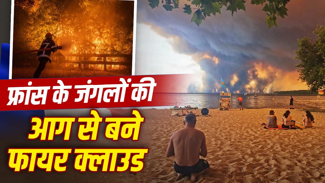
Fire clouds have been seen for the first time in France.
After a massive forest fire in the south-western part of France, huge fire clouds were seen in the sky. In scientific language these are called pyrocumulonimbus or pyroCB. This is not a normal smoke cloud. It is formed by such intense heat of fire that it itself starts creating storm-like activities. This type of cloud does not just cover the fire from above. This makes the spread of fire more dangerous. This incident is being considered very unusual in France.
Come, let us understand with this excuse that what are the fire clouds that formed after the fire in France, what will be its impact on common life?
What is a fire cloud?
Fire cloud is a very high cloud. It forms over very large and hot forest fires. Hot air, smoke, ash and water vapor emanating from the fire rise rapidly. This process may look like smoke rising from a chimney, but its scale is much larger. The air becomes cooler while going up. The moisture present around the microscopic particles of smoke and ash starts thickening. This forms a cloud. If the fire is very powerful and the atmosphere above is favourable, then this cloud can grow beyond a normal cloud and take the form of a thunder cloud.
This is called pyrocumulonimbus. Its size can extend up to several kilometers. height too muchThere may be more. From a distance it appears huge, deep and sometimes mushroom-shaped.

How does fire create its own weather?
Very strong fire heats the air near the ground. Hot air is light. That’s why she goes up fast. When this hot air reaches the top, it meets the cold air. Drops of moisture are formed. Small particles of ice can also form at higher altitudes. Mutual collision of these particles can generate electric charge. In the same way, lightning is formed in normal thunderstorm clouds.
Fire clouds contain both rising air and falling cold air. This creates powerful and unstable winds. These winds can change the direction of the fire. This becomes a dangerous cycle for fire. Fire makes clouds. Cloud creates wind. The wind further increases the fire.

The fire cloud starts affecting the air around it.
Why is it different from a normal smoke cloud?
Every forest fire produces smoke, but not every plume of smoke becomes a fire cloud. The fire must be very intense to form a fire cloud. The air temperature should be high. The land should be dry. Also, there should be the right combination of moisture and coolness in the upper layers of the atmosphere. Normal smoke flows with the wind. The fire cloud starts affecting the air around it. It can produce strong winds, lightning and sometimes strong downward gusts, so it can also be called a fire storm.
Danger of new fire due to lightning
The biggest danger of fire cloud is lightning. The lightning generated in this can fall on the nearby dry forest, grass or bushes. This can lead to new fires far away from the main fire. This is specifically called the risk of dry lightning. Many times lightning strikes, but there is not enough rain. Before reaching the ground, rain drops can become vapor only in hot and dry air. Therefore instead of being extinguished the fire spreads to new places. In the case of the France fire, there have been reports of new fires being caused by such lightning. Due to this, the fire brigades are challenged to work on many fronts simultaneously.

People living in areas with fire clouds may face many types of dangers.
Wind direction may change suddenly
The air within a fire cloud can be very unstable. Sometimes the wind is drawn towards the fire. Then the air coming down from the cloud reaches the ground in the form of strong gusts. Due to this, the flames can suddenly move in the other direction. This change can happen within a few minutes. Therefore the situation becomes extremely risky for the fire-fighters. The path which was safe some time ago may suddenly come under fire. Strong wind can blow even small burning particles far away. These can start new fires by falling on dry grass, rooftops, fields or forests.
What will be the impact on common life?
People living in areas with fire clouds may face many types of dangers. The first danger is of fast spreading fire. Changing the direction of fire may affect evacuation plans. Roads may have to be closed soon. The second danger is that of smoke. Smoke contains very fine particles. These can reach the lungs. It can be more dangerous for people with asthma, heart disease, elderly, children and pregnant women. Problems like eye irritation, cough, shortness of breath and headache may occur. The third impact may be on agriculture and the local economy. Forests, fields, houses, power lines and roads can be affected by fire. There may be loss in tourist areas also.
There will be great harm to the environment too
Severe forest fires harm trees, plants and wildlife. Many animals are forced to flee from their natural habitat. It is difficult for some creatures to find a safe place. After the fire, the upper layer of the soil may also become weak. Trees and grass hold the soil. If they burn, soil erosion may increase during rains. Ash and soil can also reach rivers or ponds. When forests burn, large amounts of carbon dioxide and other gases are released. This may make the problem of climate change more serious. However, it is considered inappropriate to attribute any single fire or single fire cloud as a direct result of climate change. But scientists believe that conditions like extreme heat, drought and frequent heatwaves are creating a favorable environment for such extreme fires.
Are their chances increasing due to climate change?
There is a growing concern about increasing heat waves and drought in Europe. When forests and grasses remain dry for long periods of time, they become fast-burning fuels. Excessive heat can increase the intensity of fire. Fire clouds have previously been recorded more in areas like Australia, Canada and America. Their appearance in France is an indication that the behavior of fire is changing. According to experts, if hot and dry conditions continue, such risks may increase across Europe.
The fire cloud formed in France is a serious natural warning. This shows that very severe fires do not spread only on the ground. It can also create a dangerous weather system in the sky. Its impact could be seen in the form of new fires, strong winds, lightning, smoke and large-scale evacuations. People’s safety is most important. Timely warnings, caring for forests, preparing for fires and understanding climate risks have become more important than ever.
Also read: Does Jantar Mantar really get the demands of the protesters met?