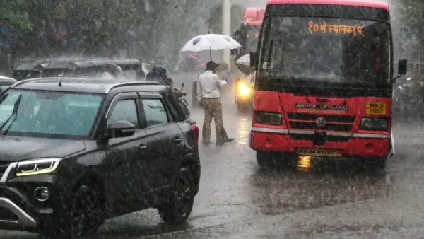
New Delhi: The India Meteorological Department (IMD) has issued a yellow alert for several districts of Maharashtra over the next 24 hours.
It is important to note that the state has been experiencing a rainfall deficit over the past few weeks. Raigad, Thane, Palghar, the Pune Ghat region, the Nashik Ghat region, and the Satara Ghat region are likely to receive heavy rainfall at isolated places on July 19.
In addition, Nashik, Ahilyanagar, Pune, Satara, Solapur, Chhatrapati Sambhajinagar, Jalna, Parbhani, Beed, Hingoli, Nanded, Latur, Dharashiv, Akola, Amravati, Buldhana, Bhandara, Chandrapur, Gadchiroli, Gondia, Nagpur, Wardha, Washim, and Yavatmal are expected to witness rain accompanied by thunderstorms and lightning at isolated locations.
Accordingly, a Yellow Alert has been issued for these districts.
Maharashtra Weather Update: Here some of the key details
- Raigad, Thane, Palghar, the Pune Ghat region, the Nashik Ghat region, and the Satara Ghat region are likely to receive heavy rainfall at isolated places.
- Nashik, Ahilyanagar, Pune, Satara, Solapur, Chhatrapati Sambhajinagar, Jalna, Parbhani, Beed, Hingoli, Nanded, Latur are expected to witness rain accompanied by thunderstorms and lightning at isolated locations.
- Dharashiv, Akola, Amravati, Buldhana, Bhandara, Chandrapur, Gadchiroli, Gondia, Nagpur, Wardha, Washim, and Yavatmal are expected to witness rain accompanied by thunderstorms and lightning at isolated places.
- The rest of the state is likely to experience light to moderate rainfall.
- The IMD has forecast thundershowers accompanied by lightning in the Pune Ghat region, Pune, Ahilyanagar, Beed, Parbhani, Hingoli, Washim, Buldhana, Akola, Yavatmal, Amravati, Wardha, Chandrapur, Nagpur, Bhandara, Gondia, and Gadchiroli districts.
- Light rainfall is expected to continue across the remaining parts of Maharashtra.
Waiting for Heavy Rain: Farmers’ Worries Deepen
It is important to note that Maharashtra is yet to receive heavy rainfall. The prolonged dry spell has started damaging crops, increasing anxiety among farmers. They are still eagerly waiting for heavy rainfall that could revive the standing kharif crops.
According to the India Meteorological Department (IMD), a low-pressure area remains active over western parts of West Bengal and adjoining northern Jharkhand in the Ganga basin. Associated with this system is a cyclonic circulation extending up to around 5.8 km above mean sea level, tilting southwestward with height.
Additionally, the monsoon trough at sea level extends from Amritsar, Karnal, Bareilly, Lucknow, Patna, through the centre of the low-pressure area over West Bengal and northern Jharkhand, and further to Diamond Harbour before reaching the northeast Bay of Bengal. The trough extends up to approximately 0.9 km above mean sea level.
Rajasthan likely to see monsoon revival from July 21: IMD
The southwest monsoon is set to revive over Rajasthan next week, with the India Meteorological Department (IMD) forecasting a fresh spell of widespread rainfall across eastern, western and central parts of the state from July 21 onwards. According to the IMD, weak monsoon conditions are likely to persist across most parts of Rajasthan for the next two to three days.
Rainfall activity is expected to increase from July 21 in parts of the Kota, Bharatpur and Jaipur divisions of eastern Rajasthan.