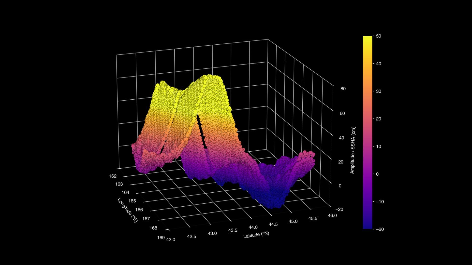
New Delhi: The Surface Weather and Ocean Topography (SWOT) satellite, a joint mission between NASA and CNES, the French space agency has captured data on the tsunami triggered by the 8.8 magnitude Earthquake at Russia’s Kamchatka Peninsula on 30 July. The entire column of seawater from the seafloor to the surface is displaced during tsunamis. The leading edge of the tsunami was measured to be about 45 cm high, which may not seem like much in the open seas, but these waves can reach 10 metres in height as the waves move over the shallow coastal regions.
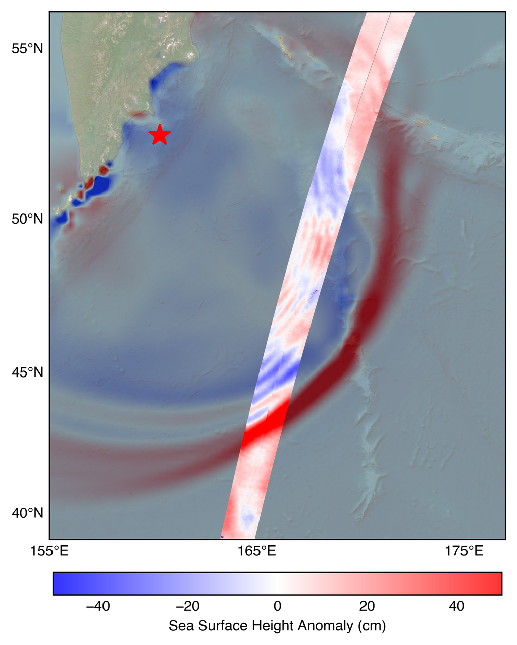
The narrow band is the satellite data, while the background is the model. (Image Credit: NASA/JPL-Caltech).
The alerts sent out to coastal communities that are potentially in the paths of tsunamis are based on forecast models. The data captured by the satellite is shown above plotted against the forecast model used by the US National Oceanic and Atmospheric Administration (NOAA). Such comparisons allow forecasters to validate their models and improve the accuracy of predictions. The satellite provides precise, granular information on the height, shape and speed of the waves. The comparison also revealed that the model used by the NOAA was accurate. The satellite observations also allows scientists to trace back the tsunami to its source.
Satellite data and modelling keep coastal communities safe
NASA Earth lead and SWOT program scientist at NASA Headquarters in Washington, Nadya Vinogradova Shiffer says, “The power of SWOT’s broad, paintbrush-like strokes over the ocean is in providing crucial real-world validation, unlocking new physics, and marking a leap towards more accurate early warnings and safer futures.” Apart from NASA and CNES, the Canadian Space Agency (CSA) and the UK Space Agency have also contributed to the SWOT satellite. Such tsunamis that displace the entire water column are triggered by either earthquakes or underwater landslides. The newly launched NASA-ISRO Synthetic Aperture Radar satellite will be able to precisely monitor such seismic events, as well as the tsunamis that follow them.