New Delhi: Satleo labs, an Ahemadabad-based New Space startup is deploying a pioneering thermal and optical imaging satellite constellation. The constellation will provide high-resolution thermal imaging capabilities, filling in gaps in the availability of high-quality temperature data, that has broad applications in various domains. The constellation of satellites can be used for more accurately estimating yield from agricultural land, enhancing climate modelling, improving the accuracy of weather forecasts, detect wildfires early, optimise heat management strategies for entire cities, and even uncover hidden archaeological remains. We spoke to CEO and Co-founder of Sateleo Labs, Shravan Bhati to better understand this exciting new constellation and the requirement for it.
Bhati explains, “Our experimental satellite mission is slated for Q1 2026 and will act as a technology demonstrator to validate our thermal imaging stack in orbit. The first operational launch is scheduled for Q4 2026, marking the beginning of our commercial data services across key sectors such as urban cooling, agriculture, and energy. We are currently assessing various launch vehicle options, including both dedicated and rideshare missions. The final choice will be guided by factors such as timing, orbital requirements, and cost efficiency. Our primary goal is to ensure mission reliability and maintain the flexibility needed to support downstream pilot projects and timely data delivery. The expected lifespan of our satellites is 5 years, with TAPAS-1 being the name of our inaugural mission.”
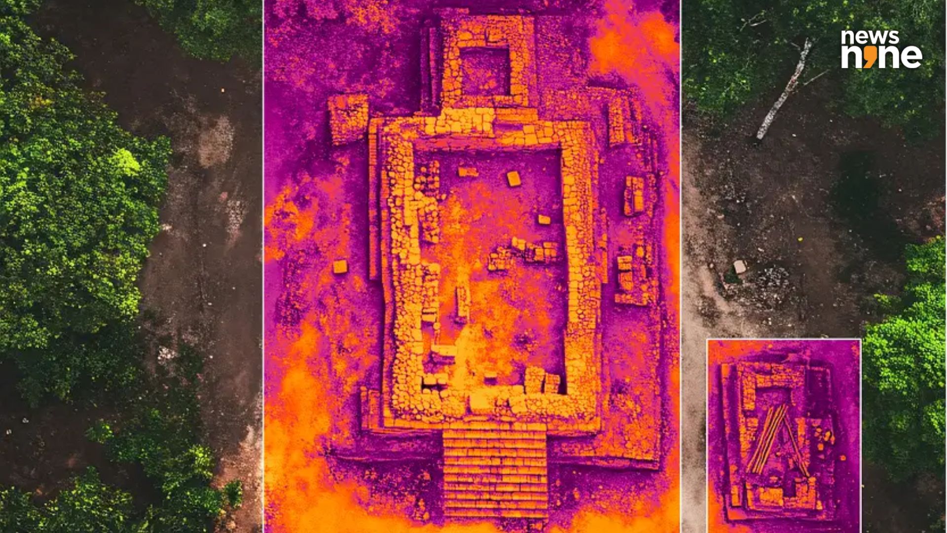
Peering beneath the ground
If you were wondering about how a thermal imaging satellite can peek underground, then you are not alone as this was the potential application that piqued our interest the most as well. Bhati told us, “SatLeo’s thermal imaging sensors are designed to detect subtle heat variations on and beneath the Earth’s surface. These variations can indicate underground structures, mineral deposits, or seismic activity zones. By capturing thermal signatures, the technology enables archaeologists and geologists to identify hidden ruins or geological formations with far greater precision than traditional methods. The system is tailored to enhance subsurface analysis, though the specific imaging resolution for these applications is optimized based on mission parameters and sensor capabilities.” Sateleo’s satellites have geological applications as well, in addition to the archaeological ones.