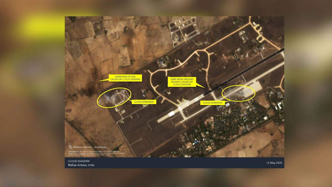
Satellite images from Naliya Airbase, located in Gujarat, are being circulated online with claims highlighting dark patches on them as damage sustained during the Pakistan attack.
The image was first produced on May 12, 2025. However, on closely observing, it can be seen that those are shadows of clouds that resulted in the discolouration of the ground.
While there is no official confirmation from the official authority. The image itself has gained attention online in the growing debate around Operation Sindoor and the four-day clash that engulfed the nuclear-armed neighbouring nations.
There had been an information war as both countries engaged in claims and counterclaims.
Even though Pakistan claimed victory among its citizens, satellite imagery reflects damages incurred by Pakistan were more serious to its military and terrorist infrastructure.
Naliya Airbase, located in Gujarat’s Kutch district. It is positioned near the Sir Creek area. Its proximity to the border makes it a strategic location for forward activity.
The recent circulation of the image has reached the news feeds of many Indians. Many tried to debunk the claim. Damien Symon (@detresfa_,) an analyst with an open source intelligence network (OSINT), weighed in on the debate.
“A new image of Naliya Airbase in India, dated 12 May 2025, is being circulated highlighting the darkening of soil around the runway as damage, however,r verification of the image reveals a shadow of a cloud overhead as the reason behind this apparent discolouration on the ground,” he said in a post on X (formerly Twitter).
The Pakistan military claimed it hit at least two dozen military installations and air bases; however, those claims had not been substantiated with visual proof. The Indian military said it had targeted 11 military bases and 9 terrorist infrastructure which were substantiated by evidence.