Israel has again published a map of India that incorrectly depicted Jammu and Kashmir as Pakistan’s region and Arunachal Pradesh as Chinese territory.
The controversial map was posted by the Israeli Defence Forces on its social media handle. India has always maintained that the Union Territory of Jammu and Kashmir would always remain an integral and inalienable part of India.
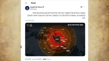
(IDF publishes wrong map of India)
IDF apologises after backlash
However, when several social media users pointed out the “mistake”, the Israeli side responded with an apology but did not remove the map as of writing this article. “This post is an illustration of the region. This map fails to precisely depict borders. We apologize for any offence caused by this image,” read the post.
(Apology posted by IDF)
Not the first time
However, this was not the first time the Israeli side had committed such a mistake. Earlier in October last year, Israel had placed Kashmir on the Pakistani side. This resulted in massive social media trolling noting the fact Prime Minister Narendra Modi was among the first leaders to condemn the attacks when Israel was attacked by Hamas on October 7, 2023. Later, Israel’s ambassador to India Reuven Azar wrote that the incorrect map was a “website editor’s mistake.” “Thank you for noticing. It has been taken down,” he said.
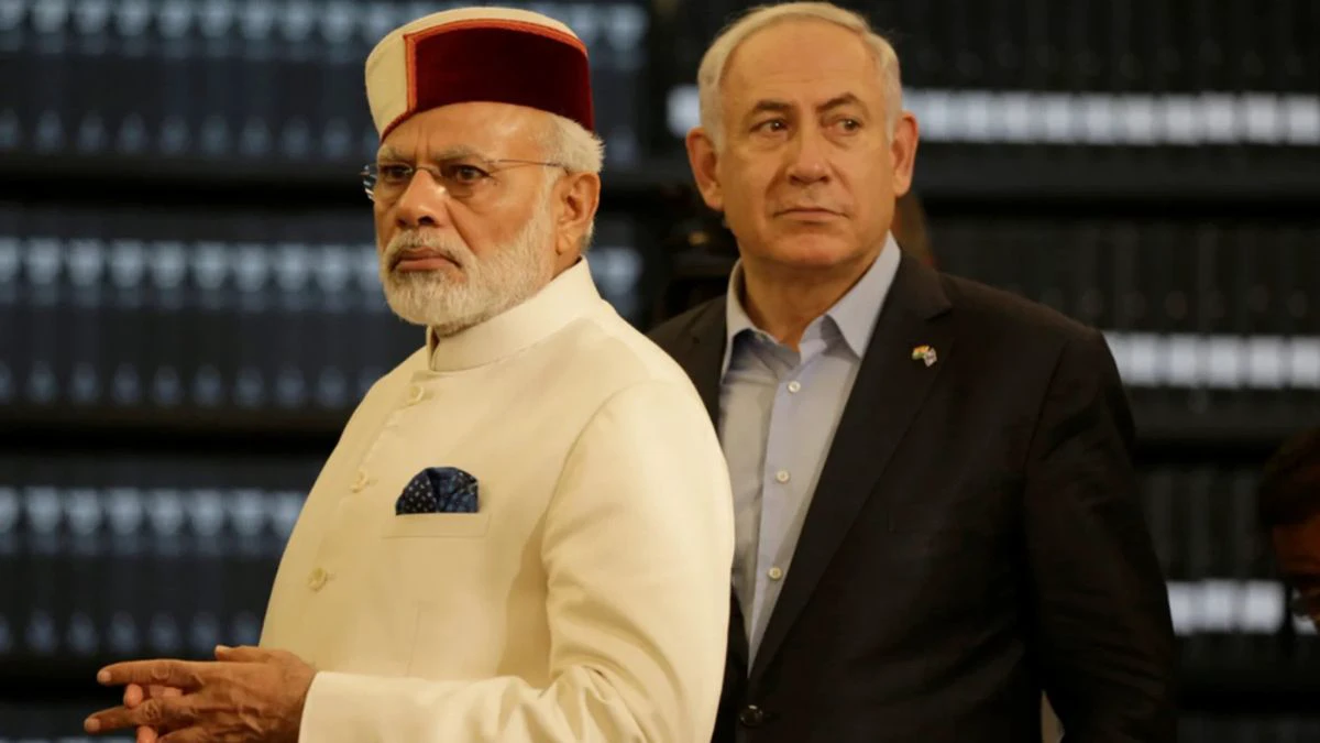
Notably, India and Israel share a good relation. In fact, Israeli Prime Minister calls his Indian counterpart “very good friend” and takes India’s stand at the difficult time. When India launched Operation Sindoor against Pakistan terrorists, Israel was among the countries which had backed New Delhi. Earlier today, Netanyahu spoke to his Indian counterpart, where he briefed PM Modi about the ongoing attack on Iran. “Received a phone call from PM @netanyahu of Israel. He briefed me on the evolving situation. I shared India’s concerns and emphasized the need for early restoration of peace and stability in the region,” PM Modi wrote on social media.
Fine for wrong depiction of Indian map
A wrong depiction of the map of India could land the violators in jail with a maximum term of seven years and a fine up to Rs 100 crore. This measure has been envisaged by the government against the backdrop of instances where certain social networking sites showed Jammu and Kashmir and Arunachal Pradesh as part of Pakistan and China respectively. The measure was taken after X had shown the geographical location of Kashmir in China and Jammu in Pakistan in 2016, triggering protests from the Indian government after which it was corrected. According to the draft, The Geospatial Information Regulation Bill 2016, it will be mandatory to get permission from a government authority before acquiring, disseminating, publishing or distributing any geospatial information of India.