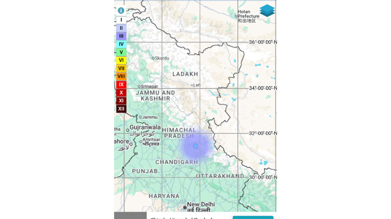
A magnitude 2.8 earthquake struck Shimla, Himachal Pradesh, on Sunday morning at 6:29 AM. Recorded at a depth of 8 km by the National Centre for Seismology, it follows an earlier seismic event recorded in Chamba this past August.
Shimla (Himachal Pradesh) [India], November 22 (ANI): An earthquake of magnitude 2.8 struck Shimla district in Himachal Pradesh on Sunday morning, according to the National Centre for Seismology (NCS). The earthquake occurred at 6:29:02 am IST on November 22 at a depth of 8 kilometres, the NCS said in a post on X.
According to the seismic data shared by the agency, the epicentre was located at latitude 31.422 degrees north and longitude 77.783 degrees east in Shimla district of Himachal Pradesh. EQ of M: 2.8, On: 22/11/2026 06:29:02 IST, Lat: 31.422 N, Long: 77.783 E, Depth: 8 Km, Location: Shimla, Himachal Pradesh. For more information Download the BhooKamp App https://t.co/5gCOtjdtw0 @DrJitendraSingh @OfficeOfDrJS @tummalasrini @GSuresh_NCS @ndmaindia https://t.co/3zaMpNhgmq — National Center for Seismology (@NCS_Earthquake) November 22, 2026
The NCS shared the earthquake details on its official social media handle, providing the magnitude, depth and geographical coordinates of the seismic event. Earlier on August 14, an earthquake of magnitude 3.0 struck Chamba in Himachal Pradesh on Friday, reported the National Centre of Seismology (NCS). The earthquake hit the district at 06:36 am.
Sharing the details on its website, the NCS said, “M: 3.0 – Chamba, Himachal Pradesh, Origin Time: 2026-08-14 06:36:28 IST, Latitude: 33.131, Longitude: 76.585, Depth: 5 km. “In a post on X, NCS said: “EQ of M: 3.0, On: 14/08/2026 06:36:28 IST, Lat: 33.131 N, Long: 76.585 E, Depth: 5 Km, Location: Chamba, Himachal Pradesh.”
Earthquakes can occur anywhere between the Earth’s surface and about 700 kilometres below the surface. For scientific purposes, the earthquake depth range of 0 700 km is divided into three zones: shallow, intermediate, and deep, as per USGS data. Shallow earthquakes are between 0 and 70 km deep; intermediate earthquakes, 70 -300 km deep; and deep earthquakes, 300 – 700 km deep. In general, the term “deep-focus earthquakes” is applied to earthquakes deeper than 70 km, the United States Geological Survey (USGS) states. (ANI)