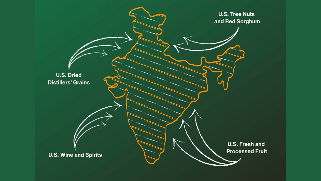
Washington/New Delhi: Amid the announcement of the India-US Interim Trade Agreement framework, a map shared by the United States Trade Representative (USTR) has generated buzz on social media. The graphic, released as part of official communication outlining the scope of the trade arrangement, depicts the entire Jammu and Kashmir region, including Pakistan-occupied Kashmir (PoK), and Aksai Chin, as part of Indian territory.
The map, published alongside details of the proposed trade framework, also shows Arunachal Pradesh within India’s territorial boundaries. It was shared with a post highlighting how the agreement aims to expand market access for American products.
US shows PoK as Indian territory
From tree nuts and dried distillers’ grains to red sorghum and fresh and processed fruit, the U.S.-India Agreement will provide new market access for American products. pic.twitter.com/mqpP10LJp1
— United States Trade Representative (@USTradeRep) February 6, 2026
“From tree nuts and dried distillers’ grains to red sorghum and fresh and processed fruit, the U.S.-India Agreement will provide new market access for American products,” USTR said in a tweet, accompanied by a map of India.
The depiction has drawn attention due to the long-standing territorial disputes involving India, Pakistan and China. In 2020, Pakistan unveiled a new political map claiming Jammu and Kashmir, parts of Ladakh, as well as Junagadh, Manavadar and Sir Creek in Gujarat as its territory. India had strongly rejected the move, calling it “an exercise in political absurdity” and dismissing Islamabad’s claims.
China has also repeatedly asserted claims over Indian territory. In August 2023, Beijing released an updated “standard map” showing Arunachal Pradesh, referred to by China as South Tibet, and Aksai Chin as part of its territory. India has consistently rejected such claims, stating that cartographic assertions do not change the ground reality.
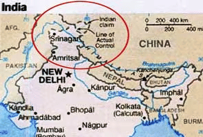
Indian map as shown on the official website of the US State Department in 2011 | Image: PTI
Notably, on earlier occasions, maps released by US agencies reportedly showed PoK as part of Pakistan. However, the latest map shared by the Trump administration clearly shows PoK as part of India, prompting strong reactions online.
Netizens react
Netizens were quick to respond, with many praising the depiction. One user said, “Thanks for conveying to Pakistan that their Azad Kashmir province belongs to India, by representation of the correct map of India in your graphics.” Another wrote, “I am seeing this for the first time. Americans are using the correct map of India.”
A third user added, “The US is using the right map of India? Miraculous!” Someone commented, “USA showing PoK and Aksai Chin as part of India!!! Our correct map is a win for us.” A post read, “Pakistan keeps bootlicking the USA. Meanwhile, the USA shows the correct map of India.”
Yet another user said, More than almonds and sorghum, the real win is the map USTR used. Whole India shown as one, including areas under Pakistan’s or China’s occupation, without cutting them out. That’s more diplomatic than any statement. Touching hearts big time!”