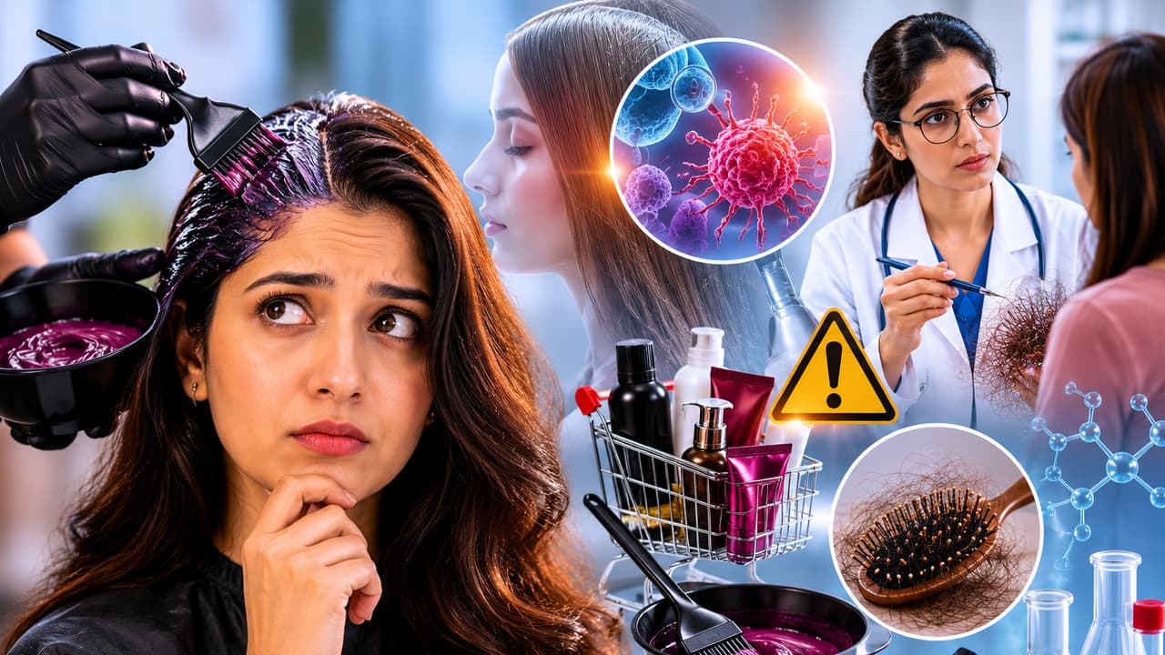
New Delhi: A SpaceX Falcon 9 has blasted off to space from the Vandenberg Space Force Base in California at 00:23 hours IST on 27 August, to launch the NAOS (National Advanced Optical System) satellite for Luxembourg, built by OHB Italia. There were payloads from two Indian New Space startups on board. Pixxel sent up three more Firefly satellites, completing phase one of its hyperspectral constellation. Dhruva Space flew two payloads for a pair of Australian startups, in the first commercial flight of its Polaris-30 (P-30) satellite bus. The flight was nominal with the booster flying and landing successfully for the 27th time. The Indian satellites were deployed over an hour into the flight.
The primary payload, NAOS and the seven piggybacking satellites on the Falcon 9. (Image Credit: SpaceX).
Dhruva Space is also providing ground stations, data-downlinking, and realtime mission management services for the Leap-1 satellite, which is an acronym for ‘Launching Expeditions for Aspiring Payloads’. On board are a pair of payloads by Australian startups, Akula Tech’s Nexus-01 AI module, and the Espresso hyperspectral imager developed by Esper Satellites. The payloads are complementary, and the AI module enables processing of the observations by the hyperspectral imager on the satellite itself, with the capability of retraining the model based on the data captured. The mission introduces the indigenously developed P-30 platform to the international market. Dhruva Space had earlier demonstrated its hardware in space with the Leap-TD payload on POEM platform of the PSLV-C58 flight in January 2024.
How the on-orbit AI intelligence platform works
Chief AI Officer of Akula Tech, Nishq Ravindranath explains, “The Nexus-01 mission represents a breakthrough in Space-based Artificial Intelligence. Our Space-ready AI model optimization technology allows us to optimize and compress any Geospatial AI/ML models to run efficiently on the edge in Space, supporting applications like fire detection, anomaly detection, and spectral analysis that provide near real-time insights to Government and Defence personnel. Furthermore, these models will improve themselves over time by continuously retraining on live sensor data. This launch will give flight heritage to five of our distinct software products while enabling the uplink of newer AI/ML models directly to the satellite throughout the mission lifetime. Most importantly, it establishes the foundation for an autonomous, coordinated constellation of Earth Observation satellites that work together as a swarm, essentially placing a Geospatial Intelligence analyst directly in Space to sense and detect critical features of interest.”

The LEAP-1 satellite by Dhruva Space. (Image Credit: Dhruva Space).
Sanjay Nekkanti, CEO and Co-founder of Dhruva Space said, “Following a successful qualification of the P-30 onboard ISRO’s PSLV-C58, Dhruva Space is excited to take its indigenously-developed P-30 satellite platform to global market. We are confident this multilateral, collaborative approach drives innovation, brings down costs, and invests in commercial capabilities to grow the business opportunities that can serve other customers and further foster a global Space economy. Teaming up with our commercial partners in Australia creates remarkable opportunities for Indo-Australian Space business, which will, in turn, foster a long-term partnership. India is already a key economic and regional partner and we see this mission symbolic of India’s status as a fast-growing Space program. We are also happy to share that our LEAP series of hosted payload missions continues to thrive, and we are observing traction from private Space players in India, Italy, France, and more.”
Pixxel completes Phase One of its hyperspectral constellation
With the deployment of the three Firefly satellites, Pixxel completed Phase One of its hyperspectral constellation. Three Pixxel satellites were previously launched by the SpaceX Transporter 12 mission back in January. Pixxel now has six satellites in a Sun-synchronous Low Earth Orbit at an altitude of 550 km. The hyperspectral cameras capture the Earth in over 135 spectral bands, or colours. The conventional cameras that we have in our smartphones capture only three or four colours. The hyperspectral imagery is useful for tracking ecosystem health indicators, monitoring environmental changes, identifying mineral deposits, assessing crop health, tracking water pollution and enhancing military surveillance as well.

A Firefly Hyperspectral satellite. (Image Credit: Pixxel).
Awais Ahmed, Founder and CEO of Pixxel said, “This launch is where our vision begins operating at scale. With six Fireflies in orbit, we can monitor the planet with a fidelity never before seen in commercial space. We are closer than ever to making hyperspectral intelligence accessible to all those working to solve humanity’s toughest challenges.” Pixxel plans to expand the constellation for boosting the revisit rate, and for packing in onboard processing capabilities for realtime intelligence.