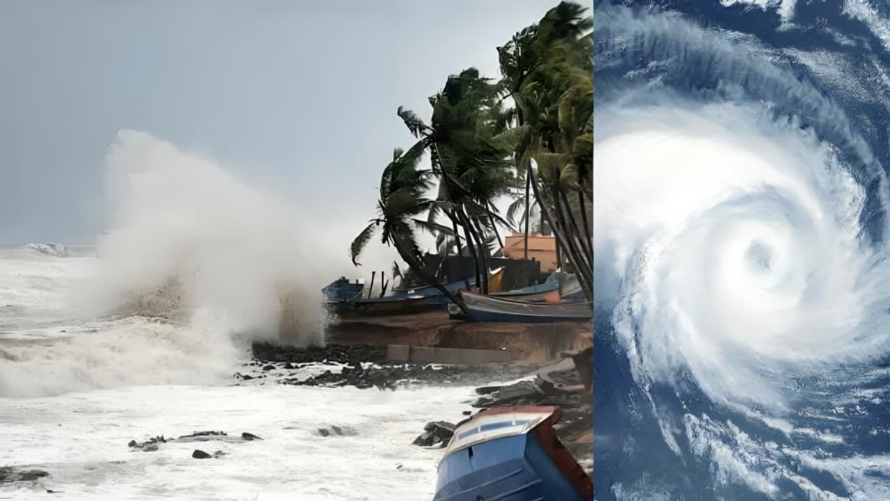
Indian Army has been placed on high alert as two weather systems, one in East Central Arabian Sea and other in South-East Bay of Bengal, intensify into Cyclone Montha within 48 hours. Andhra Pradesh, Odisha, Tamil Nadu and beyond are braced on alert.
The Indian Army has activated heightened readiness across both the east and west coasts. The twin weather systems, one over the Arabian Sea and one over the Bay of Bengal, are expected to strengthen into Cyclone Montha within 48 hours. Coordination has been established with the National Disaster Management Authority (NDMA), state disaster authorities and the meteorological department to ensure a swift response in case of impact.
Current meteorological situation Depression over the Arabian Sea
A depression lies about 700 km west-southwest of Mumbai and is expected to move westwards across the East Central Arabian Sea in the next 24 hours.
Deep depression over the Bay of Bengal
A system located around 610 km west of Port Blair and 950 km south-southeast of Gopalpur has intensified into a deep depression. It is expected to become a cyclonic storm and then a severe cyclonic storm by 28 October.
Forecasted landfall
The Bay system is likely to cross between Machilipatnam and Kakinada in Andhra Pradesh during the evening or night of 28 October as a severe cyclonic storm with maximum sustained winds of 90–100 km h⁻¹ and gusts up to 110 km h⁻¹.
Likely impact areas
Coastal Andhra Pradesh, especially the belt between Machilipatnam and Kakinada, is on red alert for 28 October. Coastal Odisha and Tamil Nadu are also expected to experience strong winds and heavy rainfall.
The depression over the Arabian Sea could affect parts of the west coast as it moves, meaning Karnataka, Goa and Lakshadweep must stay vigilant.
Army readiness and response
The Army has deployed Disaster Response Columns (DRCs) in all likely-affected states and union territories:
- Karnataka: 8 dedicated + 9 reserve
- Kerala: 6 + 7
- Andhra Pradesh & Telangana: 10 + 7
- Tamil Nadu: 7 + 8
- Lakshadweep & Minicoy Islands: 1 + 1 These stand-by forces will assist civil authorities in evacuation, relief, and rescue if needed.
Operational control rooms have been set up to monitor logistics, liaison with state agencies, and manage rapid deployment.
State-level mobilisation
In Andhra Pradesh, the government has appointed senior IAS officers as Special Officers in each coastal and adjoining district. They will oversee relief, evacuation, damage assessment and service restoration. The Chief Secretary has instructed immediate activation of cyclone control rooms, full coordination across departments and urgent readiness of all systems.
In Odisha, seven districts have been issued red warnings for extremely heavy rainfall, with a broader area under yellow alert. Leaders have cancelled employee leave and prepared shelters and rescue gear in advance.
Public advisories and sea-warnings
Fishermen along the Bay of Bengal and adjoining coasts have been strictly advised against venturing into open seas. The Indian Coast Guard has already shepherded hundreds of fishing vessels to safety. Residents in vulnerable zones, especially near coasts, low-lying areas and rivers, are urged to stay alert, avoid unnecessary travel and follow instructions from local authorities.
Departments like roads, power, communications and health have been directed to ensure services remain uninterrupted or are restored quickly after any disruption.
Why two systems matter
This unusual situation of twin depressions, one over the Arabian Sea, another over the Bay of Bengal, raises the risk for a broader coastal impact. While the Bay system is the immediate threat, the Arabian Sea system reinforces the need for coast-to-coast vigilance. Together these systems can test the readiness of defence, civil and disaster-management agencies.
Key take-aways for citizens
- Keep monitoring local updates from the IMD, NDMA and state disaster control rooms.
- Prepare simple supplies: Torch/light, essential medicines, basic food, a mobile phone-charger and emergency contacts.
- If you live in coastal or flood-prone zones, locate nearest shelter and evacuation route.
- Do not use roads or beaches during high wind and rain warnings. Stay indoors when possible.
- Farmers, fishermen and workers in exposed areas should be especially cautious, and avoid risk during the storm period.
Over the next 48 hours:
The systems will continue to deepen and move. By October 28 evening/night, the Bay system is expected to make landfall near the Andhra coast.
After landfall, heavy rainfall, storm surge and strong winds may affect infrastructure, homes, power lines and transport. The Army and civil teams will shift from preparedness into active response mode: evacuations, rescues, road clearances, restoring services.
Post-storm:
Damage assessment, relief distribution and restoration of normalcy will be major tasks.
As Cyclone Montha gathers strength and heads towards India’s eastern coast, the joint readiness of the Indian Army, state governments, the NDMA and local agencies are all set to face the threat.
(With ANI inputs)