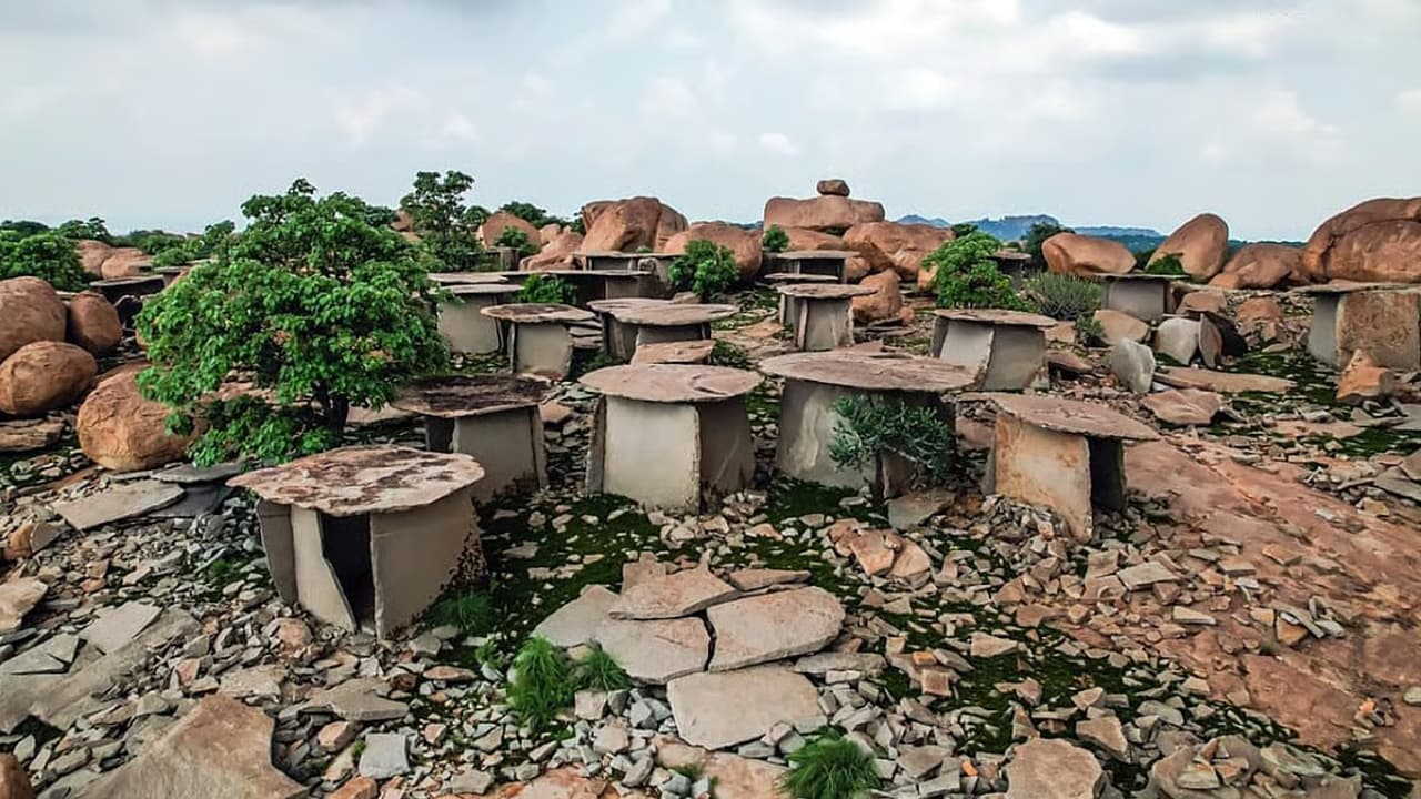
A digital mapping survey in Karnataka has found that 314 of 848 officially protected monuments could not be located. The Karnataka Digital Heritage project used 3D laser scanning and mapping to document the state’s historical monuments.
Believe it or not, hundreds of historical monuments officially listed as protected in Karnataka have vanished from the map. A recent survey using 3D laser scanning and digital mapping has revealed that, out of 848 notified monuments, only 534 could be physically located. The remaining 314 protected sites are currently untraceable, raising concerns over the preservation and documentation of Karnataka’s historical heritage.
The startling finding came to light during the ‘Karnataka Digital Heritage’ project, an initiative aimed at creating a digital record of protected monuments along with their exact geographical coordinates.
A Devaraj, Commissioner of the Department of Archaeology, Museums and Heritage, explained how the issue arose.
“These monuments were first declared protected under old, pre-independence laws such as the Ancient Monuments Preservation Act 1904, the Hyderabad Ancient Monuments Preservation Act 1337F (1927), and the Mysore Ancient Monuments Preservation Act 1925,” he said.
“Later, the Karnataka Ancient and Historical Monuments and Archaeological Sites and Remains Act came in 1961. It stated that monuments protected under the old Acts would continue to receive protection. However, no physical verification was carried out at that time,” he added.
As a result, when the department’s team began mapping the monuments, 314 notified sites could not be located. The old records often mentioned only the names of villages and did not provide precise locations, making it extremely difficult to trace the structures.
The protected sites include temples, mosques, churches, tombs, forts, palaces, wells, caves and rock carvings, many of which are more than 100 years old.
Where Did The Monuments Go?
Several factors are believed to have contributed to the disappearance or loss of these protected sites, with rapid urbanisation and displacement among the major concerns. In several locations, even local residents reportedly have no knowledge that a protected historical monument once existed in their area.
“Now that the department has completed the digital mapping of the 534 monuments with their exact locations, there is no risk of losing them,” the Commissioner said.
However, senior archaeologist Ravi Korisettar offered a different perspective.
“I don’t think the notified monuments are completely destroyed. They have just not been brought to light,” he said, suggesting that some of the structures could still exist but may have been incorporated into local communities or put to other uses.
Korisettar also suggested that Gram Panchayats should assist survey teams by providing information about historical sites located within their jurisdictions.
According to department sources, several archaeological sites have been converted into agricultural land. Some monuments may also have been submerged during the construction of large government dams.
In some villages, local residents have reportedly formed trusts to manage historic temples themselves. In other cases, historical stones are being used for everyday purposes, including tying cattle.
Regional Neglect And Expert Concerns
Sanjeev Kumar P, an associate on the Karnataka Digital Heritage project, highlighted a regional disparity in the preservation of Karnataka’s historical monuments.
“Monuments in the Mysuru and Bengaluru divisions are relatively well preserved. But they are severely neglected in the Belagavi and Kalaburagi divisions,” he said.
Professor Venkatarav Palati from the Department of History at the Central University of Kalaburagi also pointed to a lack of awareness about the region’s heritage.
“It is true that due to a lack of awareness, historical monuments in this region are neglected,” he said.
Palati has submitted a proposal to the university’s Vice-Chancellor seeking permission to conduct a survey of the area.
“Movable monuments can be preserved at the university or handed over to the archaeology department,” he added.
Karnataka Digital Heritage Project
The digitisation project began in 2019 and was completed in 2024. The initiative used modern technologies, including 3D laser scanning and digital mapping, to document protected monuments and establish their precise geographical locations.
Following the completion of the monument mapping exercise, the team has now begun work on digitising 18 notified museums in Karnataka.
Meera Iyer of INTACH praised the initiative and highlighted the importance of documenting the state’s heritage.
“So many monuments have been lost to unchecked urbanisation in recent years. In this context, digitising the monuments is a very good step,” she said.
The discovery of 314 untraceable protected monuments highlights the challenges involved in preserving Karnataka’s vast historical legacy. While digital mapping has helped establish precise records for hundreds of monuments, the inability to locate more than 300 notified sites also underlines the need for regular physical verification, better documentation and greater public awareness about the state’s heritage.