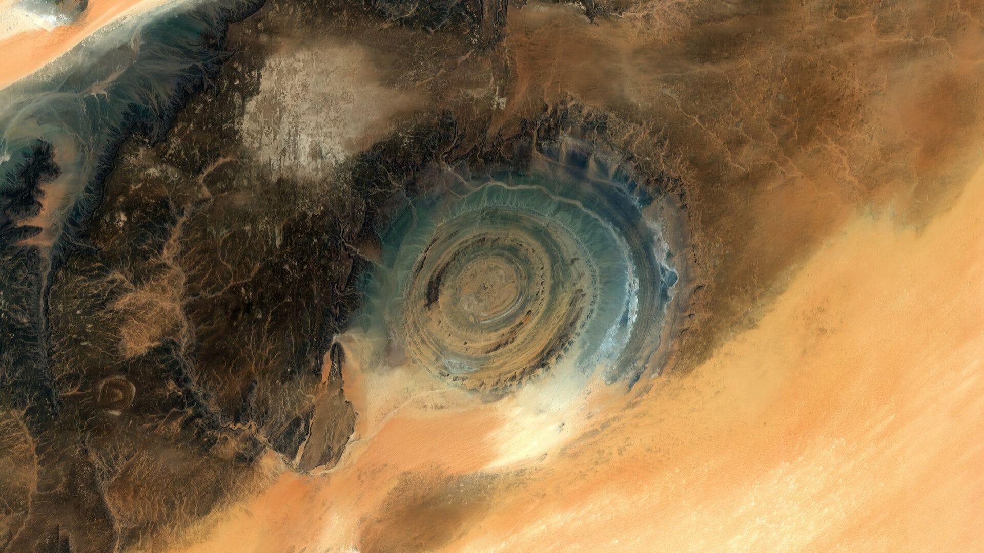
New Delhi: The Copernicus Sentinel-2 mission operated by the European Space Agency has captured the Richat Structure in the Sahara Desert of Mauritiana. The giant feature is sitting in a sea of golden sand, and was once thought to be the site of a meteor impact. Scientists now know that the structure is believed to have been caused by the upliftment of a large dome of molten rock, that was subsequently shaped by wind, sand and water erosion on the surface. Geologists estimate the structure to be at least a 100 million years old. The series of concentric rings resembles a bull’s eye, which is why it has been dubbed the Eye of Sahara or the Eye of Africa.
The Richat Structure measures 50 kilometres across, and is easier to observe from space than from the ground. From the earliest crewed missions, the feature has served as a familiar landmark. The formation exposes layers of sedimentary rocks in different places, depending on the rate of the various types of rocks. The red and pink regions in the outer rings are quartzite sandstones that are resistant to eriosion. The central rings are about 80 metres tall, with older rocks forming the outer rings.
The Mysteries of the Richat Structure
The Richat Structure is located in one of the most remote and isolated regions of the world. Local nomadic communities traverse the region herding camels, goats and sheep. There are scattered wells and oases where traditional leather poches are used to draw water. The Arabic name of the feature, originates from risat meaning feathers, resembling the opening of these pouches. The elevated ridged hills are used for seasonal grazing during rare wet periods, and also offers shelter from sandstorms. The concentric rings have long served as a natural waypoint for caravans crossing the Erg Oudane dune fields. There are several rock art sites with petroglyphs in the exposed sandstone regions, dating back to the Neolithic age when the Sahara was green.