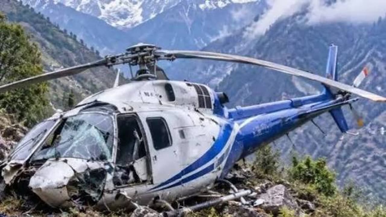
Six people, including five pilgrims from Karnataka and pilot Captain Himanshu Sabharwal, died when a helicopter crashed near Joshimath in Uttarakhand on October 30. The crash has raised questions about aviation safety in the Himalayas.
Arun Salunke, Prathapa, Shankar Gowda, Sudheer K. and H.S. Nataraja set out from Karnataka as friends on a pilgrimage. On October 30, somewhere near Joshimath in Uttarakhand, they died together, along with the man entrusted with flying them home, Captain Himanshu Sabharwal of Delhi. The grief belongs first to their families. But the question that follows belongs to the whole country: could better machines, sharper weather information and firmer rules have kept that helicopter in the air?
The facts so far are brief. The aircraft was a small single-engine AS350B3, registration VT-HCX, operated by Trans Bharat Aviation. According to the Ministry of Civil Aviation, it lifted off from Badrinath at 1.14 pm carrying five passengers and one pilot. The DGCA, India’s aviation regulator, sent a team for an initial assessment, and the Aircraft Accident Investigation Bureau, the agency that probes air crashes, has taken up the inquiry. Investigators will need to answer three things: what equipment was on board and working, what weather picture the pilot had, and whether any alert or decision might have changed the ending.
Those questions matter because the Himalayas punish small errors. Flying over Bengaluru or Delhi, a pilot has a flat horizon and room to recover. Between mountain ridges, there are narrow valleys, winds that shift without warning, clouds that roll in within minutes, and often no space to turn around. A helicopter can be in perfect mechanical health and still be in mortal danger the moment its pilot loses sight of the slopes.
Consider what happens when cloud swallows the view. A pilot threading between peaks navigates by eye, using the ground, the hills and the skyline as anchors. Remove those anchors and the brain struggles to tell where the aircraft truly is. One can feel level and safe while drifting steadily towards a rock face.
Thin air adds a second trap. Rotor blades fly by shoving air downward; the heavier the air, the easier the lift. High up, the air is sparse, so the blades must work much harder for the same result, and hot afternoons thin it further. Add passengers, luggage and fuel, and the power left in reserve can shrink to almost nothing. Then come the winds. Air pouring over a ridge can plunge downward on the far side like water over a weir, pressing a helicopter towards the ground. If the pilot lacks height or spare engine power, there may be no way out.
Technology cannot flatten mountains, but it can give a pilot precious seconds of foresight. A Helicopter Terrain Awareness and Warning System, or HTAWS, pairs satellite positioning with a stored map of the terrain and shouts a warning, on screen and aloud, when a hillside lies ahead, giving time to climb or turn while power and space remain. Synthetic Vision goes further, painting a computer-drawn landscape of valleys and obstacles on the cockpit display even when the real one is hidden by cloud, much like a three-dimensional map that never fogs over. It sharpens awareness, though it does not make bad weather safe.
Other safeguards work before and after the flight. Automated weather stations and digital feeds deliver current readings of wind, rain, visibility and cloud, while cameras along mountain corridors show whether a valley is open before anyone enters it; sometimes the wisest technology is simply the decision to wait. Health and Usage Monitoring Systems, or HUMS, listen to the helicopter’s vibrations, tracking the engine, gearbox and spinning parts for the faint tremor that precedes a failure, so engineers can intervene on the ground. Satellite tracking sends the aircraft’s position to a monitoring centre at regular intervals; it cannot stop a crash, but it tells rescuers where to look.
India has already adopted some of these for Char Dham flights, the high-altitude pilgrimage circuit that includes Badrinath, with satellite tracking, automated weather observation, designated GPS routes and limits on aircraft weight. Yet in August 2026 the government told Parliament that HTAWS and HUMS were not compulsory on the single-engine helicopters that typically fly these routes. Whether that gap should remain is now a pressing question. Manufacturers, meanwhile, are moving ahead: Airbus fits its Helionix digital cockpit to several modern models, combining flight data, maps, terrain alerts and, where fitted, synthetic vision, and is developing camera-assisted guidance for difficult approaches. Such tools lighten a pilot’s burden, though availability depends on the aircraft type and certification.
Equipment alone is not enough. Helicopters must stay grounded when weather dips below approved limits. Pilots need room to turn back before a cloud-filled valley closes behind them. Operators must work out passenger weight, fuel and available power for the real altitude and temperature of the day. Regular mountain training, honest simulator practice and cancellation decisions made free of commercial pressure complete the picture.
No device promises that an aircraft will never fall. But a well-equipped machine, a disciplined crew and the courage to say no can shrink the odds dramatically. The truest memorial to the six who died above Joshimath would be a Himalayan helicopter service that never has to count its dead again.
(Girish Linganna is an award-winning science communicator and a Defence, Aerospace & Geopolitical Analyst. He is the Managing Director of ADD Engineering Components India Pvt. Ltd., a subsidiary of ADD Engineering GmbH, Germany.)