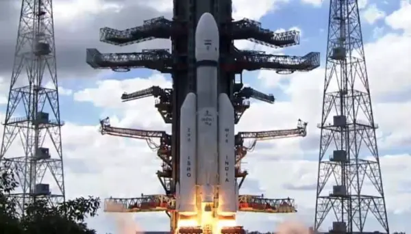
The Indian Space Research Organisation is gearing up for the launch of its GSLV-F17 mission, which will lift the advanced EOS-05 spacecraft into space from the Satish Dhawan Space Centre in Sriharikota.
Operating as the 19th flight of Indias Geosynchronous Satellite Launch Vehicle, the GSLV-F17 rocket will utilize a 4-metre diameter Ogive composite payload fairing.
Liftoff will occur from the Second Launch Pad, guiding the spacecraft into a Sub-Geosynchronous Transfer Orbit (Sub-GTO). Also recognized by its series moniker GISAT-1A under ISRO’s GEO Imaging Satellite program, the payload represents a major milestone as the nation’s premier imaging satellite positioned directly in geosynchronous orbit.
The Advantage of Geosynchronous Earth Observation
Traditional Earth observation spacecraft typically favor low Earth orbits, meaning they only sweep over specific geographic points at periodic intervals. By contrast, EOS-05 will sit approximately 36,000 kilometres above the equator. Because its orbital speed matches the rotational velocity of the planet, the satellite maintains a near-fixed position relative to the ground. This stationary vantage point enables continuous surveillance of the Indian subcontinent and neighboring marine zones.
The mission profile is engineered to deliver high-cadence data:
* Routine Monitoring: Near-real-time imagery refreshes roughly every 30 minutes.
* Priority Tracking: Revisit intervals for critical targets can narrow down to just five minutes.
* Continuous Coverage: Persistent watch over designated areas without the coverage gaps typical of low-orbit alternatives.
Strategic and Practical Applications
The persistent observation capabilities of EOS-05 translate into critical support across multiple sectors. Meteorological agencies can track shifting cloud formations and rapid weather developments, while agricultural and water-resource authorities can closely monitor crop health and hydrological shifts.
Furthermore, the high-frequency imaging schedule equips disaster management teams with vital tools to observe fast-moving emergencies like cyclones, floods, and forest fires in real time, alongside bolstering strategic and security tracking requirements. Mastering imagery capture from a geostationary distance of 36,000 kilometres demands exceptional engineering precision to ensure steady operations and high-resolution output across vast spatial expanses.