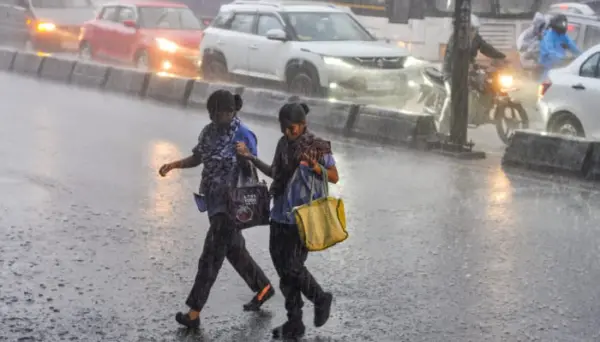
New Delhi: The India Meteorological Department (IMD) has issued a cautionary forecast for the remainder of the southwest monsoon season after a much-needed revival in July brought near-normal rains to large parts of the country.
The weather agency on Friday predicted below normal rainfall across India as a whole for August, while the second half of the monsoon in August-September is also likely to be below normal.
IMDs monthly outlook for August suggests the country is most likely to receive below normal average rainfall of less than 94% of the Long Period Average (LPA). Average rainfall for August (period 1971-2020) is 254.9mm. Rainfall is also likely to be below 94% of LPA of 422.8mm for the combined August-September period.
The outlook maps show below-normal rainfall probabilities over large swathes of the country, though several pockets are expected to do better. Parts of the eastern peninsula, Central India, northern parts of northwest India, and East & Northeast India have a higher chance of normal to above-normal rains during both August and the second half of the season.
The primary reason is the ongoing El Nio over the equatorial Pacific. IMD scientists noted that moderate El Nio conditions currently prevail, with sea surface temperatures above normal across key regions. These conditions are forecast to strengthen further through the remaining monsoon months. While the agencys Monsoon Mission Coupled Forecasting System (MMCFS) points to continued El Nio influence, some international models suggest a positive Indian Ocean Dipole (IOD) could develop by September, which often supports better rainfall over India and may partially offset the Pacific warming.
Temperature to remain above normal
Temperature outlooks for August indicate normal to above-normal minimum temperatures over most parts of the country. Maximum temperatures are also likely to remain above normal in large areas, though some pockets in northwest and Central India, along with isolated southern peninsular regions, may see normal to below-normal daytime highs.
Despite the subdued national forecast, active weather systems continue to bring relief in certain regions right now. IMD scientist Naresh Kumar highlighted that a depression over Vidarbha is driving heavy to very heavy rainfall in Gujarat and parts of Maharashtra, with red alerts issued for extremely heavy spells exceeding 12-20 cm in northern Gujarat.
Heavy rains are also expected in South India, Northeast India, and the Western Himalayas over the coming days.
In Kerala, which endured a weak phase earlier, the monsoon has turned active. IMD scientist Neetha K. Gopal said good rainfall, especially in hilly areas, is likely today and tomorrow, with orange and yellow alerts for several districts. Fishermen have been advised against venturing into the sea along Kerala, Karnataka, and Lakshadweep coasts.
Julys stronger performance, aided by multiple low-pressure systems, helped the country recover from an earlier deficit. However, with IMD predictions for the second half of the monsoon season, August and September will be decisive.