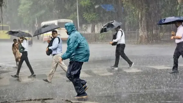
Naidunia Representative, Bhopal: The monsoon, driven by a low-pressure system over the border regions of southeast Rajasthan and Madhya Pradesh, continues to bring steady rainfall to the state.
On Friday, several districts received rain, with Mandla recording the highest rainfall in the state at 7 mm by 5:30 PM.
In the capital city of Bhopal, weather conditions changed around 4:00 PM, bringing a spell of moderate rainfall, which provided much-needed relief from the heat in the capital and surrounding areas.
Multiple Weather Systems Active Across The Region
According to the Meteorological Centre, several weather systems are active simultaneously:
– Monsoon Trough: The trough passes through Guna and Sidhi in the state, extending directly toward the Bay of Bengal. Another trough is extending from North India via Rajasthan, Haryana, and Punjab.
– Cyclonic Depression: A cyclonic circulation is positioned over Gangetic West Bengal and Bangladesh.
– Western Disturbance: A western disturbance is currently active over the Jammu region.
Due to the combined effect of these active weather systems, monsoon activity is expected to intensify across Madhya Pradesh in the coming days, which may lead to moderate to heavy rainfall in several districts.
District-Wise Rainfall Recorded Till 5:30 PM
|
City |
Rainfall Recorded (in mm) |
|
Mandla |
7.0 |
|
Chhindwara and Ratlam |
5.0 |
|
Dhar |
4.0 |
|
Rajgarh |
3.0 |
|
Guna and Indore |
1.0 |
|
Ujjain |
1.0 |
|
Jabalpur |
0.6 |
|
Datia |
0.4 |
|
Narmadapuram |
0.2 |
Temperatures In Major Cities
|
City |
Maximum (in degrees Celsius) |
Minimum (in degrees Celsius) |
|
Bhopal |
29.4 |
23.2 |
|
Indore |
29.9 |
22.4 |
|
Gwalior |
33.5 |
25.4 |
|
Jabalpur |
32.2 |
24.2 |
Delhi-NCR Weather
Delhi-NCR is expected to experience a typical monsoon day on Friday, with generally cloudy skies, intermittent light rain and humid conditions. The IMD has predicted one or two spells of very light to light showers likely accompanied by thunderstorms and gusty surface winds during the day.
According to IMD, general cloudy sky conditions will prevail with one or two spells of very light to light rains from forenoon to afternoon. Surface wind is expected to blow at a speed of 20-30 kmph, gusting to 40 kmph at many places. Another spell of light rain towards the evening or night is possible.